Ostrobothnia
Jeppo
Land & Livelihood
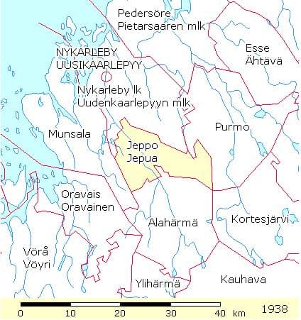
Jeppo is land bound by other parishes, but is still only 10 kilometers from the mouth of the Nykarleby River at the Gulf of Bothnia. The Nykarleby River runs through the center of the parish for about 12 kilometers. The settlements and fertile arable land lies on either side of and near the river. 6
This map of the Jeppo Parish from 1938 displays
on the HisKi project website, made available by
the Genealogical Society of Finland.
Parish History
- The area of Jeppo is first mentioned as the settlement of ‘Epu’ in the early 16th century. ‘In 1548 there were 189 inhabitants including 26 farmers.’ 8
- Jeppo was originally part of the large Pedersöre parish
- In 1607 it became a part of the Nykarleby parish
- In 1863 the Imperial Senate gave permission to engage a chapel pastor for Jeppo
- In 1867 the Imperial Senate gave sanction for Jeppo to be an independent parish
- In 1871 Jeppo began keeping its own church records, so that often is considered the year the parish began.
- It wasn’t until July 3, 1906 that the Imperial Senate gave its final decision that Jeppo was an independent parish 6
Parish Records
Because parish Communion records are listed by village and farm names and because farm names often were used as a part of a person’s name, it is interesting to note the following farms.
Since the villages and farms of Jeppo were recorded in T.W. Karsten’s work, Svesk Bygd I Osterbotten: Nu Och Fordom, records were not reviewed in Parish Communion records. 9
To open a printable list of Jeppo villages and farms, click here.
Of Interest
From the time Jeppo began keeping its own parish records, in 1871, four farms from the village of Lassila chose to remain in the Nykarleby parish. They had no interest in participating in building the new chapel and felt the Nykarleby Cemetery was closer to their farms. So, the records of the Runt, Knuts, Knock and Levälä farms were listed in Ytterjeppo village in the Nykarleby parish from 1871 on. 6
Villages & Farms
- Stenbacka
- Kaup
- Holm
- Mjölnars
- Finskas
- Måtar
- Lavast
- Back
- Käppå
- Kamppinen
- Skog
- Romar
- Fors
- Silvast
- Grötas
- Bösas
- Jungar
- Gunnar
- Tollicko
- Jungard
- Ruotsala
- Mietala
- Slangar
- Lassila
- Hilli
- Kaukos
- Kojonen
- Nybyggar
- Ojala
- Heikfolk
- Lillas
- Bärs
- Lussi
- Runt
- Knuts
- Knock
- Levälä
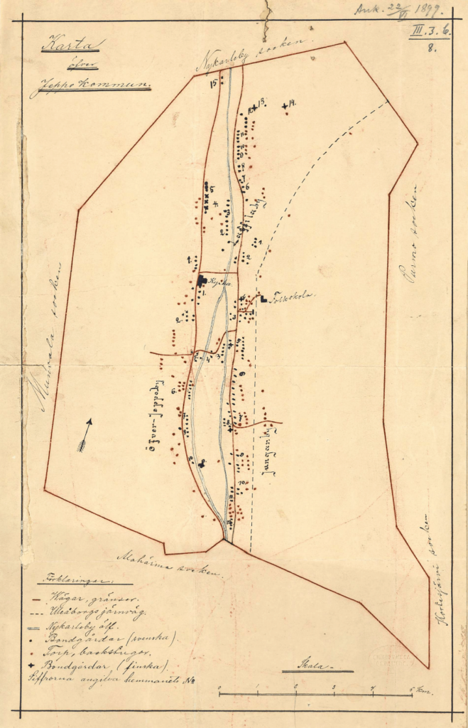
Below is a map of the Jeppo parish dated 1899. Village names are spelled out and farms are marked using dots. 7
This Jeppo parish map is in the public domain.
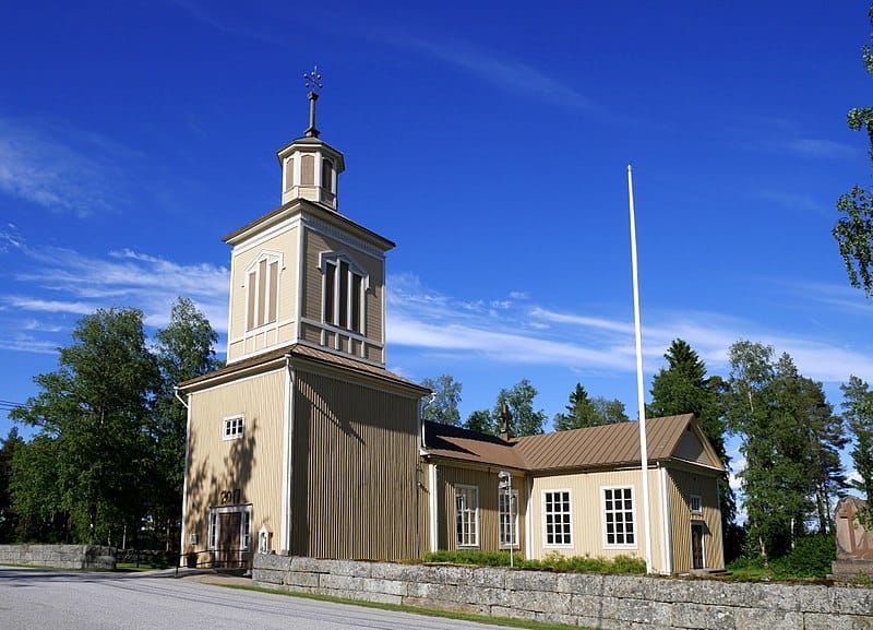
Parish Church
The Jeppo chapel built by parishioners opened in 1861. It was built as a traditional wooden cross-church with a tower structure in the center. The center tower caused the walls to bow, so the tower had to be torn down. Between 1875 and 1876 a bell tower was built at the entrance of the church.
Unfortunately, the parsonage (the home where the minister and family lived) burnt down December 29, 1886. The parish records stored in the parsonage from 1871 to 1886 were destroyed.
The ground for the church and the burial site was donated by Fredrick Andersson Stenback. 6
Jeppo Church. This file is licensed under the Creative Commons Attribution-Share Alike 4.0 International license. Attribution: Santeri Viinamäki 3
To view a video of the Jeppo church, click here.
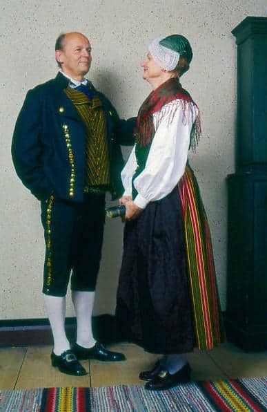
Folk Dress
Parish folk dress can be recognized by its style, colors and patterns.
Jeppo Folk Dress photo used with permission of the Brage costume agency.
References
- Genealogical Society of Finland, HisKi project, Jeppo parish, http://hiski.genealogia.fi/hiski/a1igxb?en+0130
- Jeppo Church, https://www.nykarlebyforsamling.fi/kyrkor-och-lokaler/nykarleby-kyrka/jeppo-kyrka
- Jeppo Church image, https://commons.wikimedia.org/wiki/Category:Jeppo_Church
- Jeppo Church video, https://www.youtube.com/watch?v=v_qegn3a9mc
- Jeppo Folk Dress image, Brage costume agency, https://www.brage.fi/sve/draktbyra/draktbyran/folkdrakter/view-163648-69
- Jeppo Hembygdsförening, Historik over Jeppo, Jakobstads Tryckeri och Tidnings AS, 1988, pages 154 – 161, 183
- Jeppo Parish map, ‘Karta ofver Jeppo kommun’, 1889, http://www.doria.fi/discover?query=jeppo&scope=10024%2F78800
- Jeppo Village, https://en.wikipedia.org/wiki/Jeppo_(village)
- Karsten T.W., Svesk Bygd I Osterbotten: Nu Och Fordom, Helingfors, 1923, pages 180 – 183