Ostrobothnia
Korsnäs
Land & Livelihood
Korsnäs is the most western mainland parish in Finland. It has a long, rocky coastline along the Gulf of Bothnia. The three largest islands are Halsön, Bredskäret and Södra Björkön. “Because of the post-glacial rebound, most of the area that today forms the Korsnäs parish stood under water until around 1000 AD.” 3
Livelihood came primarily from fishing and farming. There were also seal hunts lasting 12 to 15 weeks each year in the early spring. 8
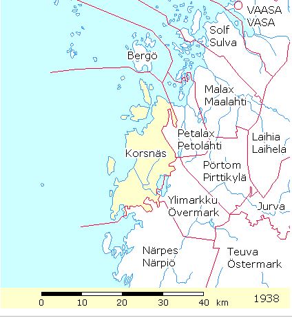
This map of the Korsnäs parish in 1938 displays on the HisKi project website, made available by the Genealogical Society of Finland.
Parish History
It is believed that Finnish speaking people from Häme used the coast of Korsnäs for fishing on a seasonal basis. The Swedish speaking settlers came to the area in the 13th or 14th centuries. 4
- Korsnäs originally was a part of the Närpes parish
- In 1604 Korsnäs became a parish chapel under the Närpes parish
- In 1887 it became an independent parish 4
Parish Records
Villages and farms of Korsnäs were recorded in T.W. Karsten’s work, Svesk Bygd I Osterbotten: Nu Och Fordom. 6 Korsnäs Parish Communion records were not used to confirm these findings.
Because parish Communion records are listed by farm name and because farm names often were used as a part of a person’s name, it is interesting to note the following farms.
To open a printable list of historic villages and farms in Korsnäs (pdf), click here.
Historic Villages
The historic villages in the Korsnäs parish include:
- Edsvik
- Harvström
- Korsbäck
- Kyrkobyn (the church village)
- Moikipää (now called Molpe)
- Taklaks
- Träskböle
- Töjby
- Överträsk
Farms
- Skyl
- Gull
- Rein
- Markusfolk
- Mannfolk
- Nissper
- Nygårds
- Rusk
- Ragvals
- Mars
- Uppels
- Hovman
- Mattfolk
- Pellfolk
- Norrgård
- Mätts
- Antfolk
- Lillmars
- Marielund
- Riddar
- Hartvik
- Holti
- Sandsten
- Kronbacka
- Mars
- Mattans
- Åbb
- Jut
- Båsk
- Lillbåsk
- Ingels
- Lassas
- Bäcks
- Helenlund
- Korsbäck
- Häggvik
- Back
- Råbacka
- Vadbacka
- Granskog
- Granlund
- Mars
- Norrgård
- Nygårds
- Tomasfolk
- Jobbens
- Säbbfolk
- Antfolk
- Pått
- Mann
- Jut
- Stenlund
- Österholm
Mokipää is mentioned in historical documents as early as 1490. 4
- Träskvik
- Taklaks
- Västerlaklaks
- Bjurbäck
- Västerlund
- Åblad
- Lindström
- Gränlund
- Kamb
- Höglund
- Strandholm
- Västerholm
- Västermark
- Blom
- Östermarks
-
- Träskbacka
-
- Högbacka
-
- Härtsbacka
-
- Träskböle
-
- Österbacka
-
- Asplund
- Ulvens
- Mars
- Vitans
- Geust
- Stuns
- Pil
- Mannfolk
- Storgeust
- Storås
- Österdal
- Västerdal
- Blacknäs
- Stenholm
- Sandbacka
- Viitaniemi
Parish Church
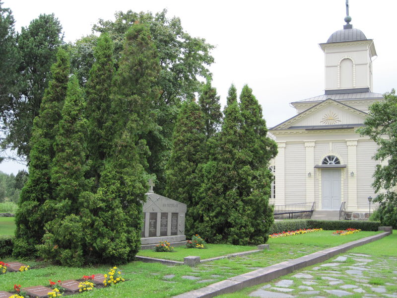
In the 1660’s a chapel was built, which remained until the mid-1800’s.
A new church and parsonage were built in 1831. The church was designed by the famous architect, Carl Ludvig Engel. Many items from the chapel were kept and used in the new church, such as parts of the platform and altar. The belfry built in the 1600’s stands near this church. 3 and 5
The Korsnäs Church and cemetery. This file is licensed under the Creative Commons Attribution-Share Alike 3.0 Unported license. Attributed: Hotarju
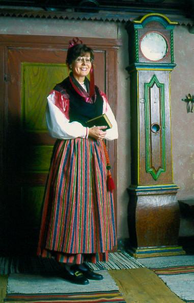
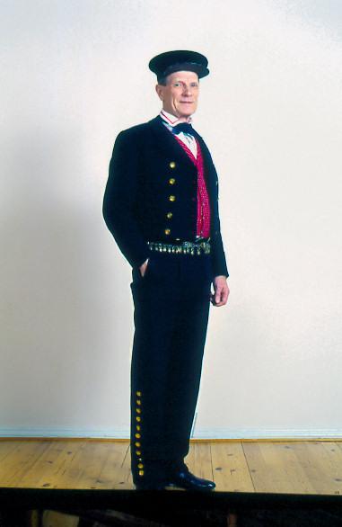
Folk Dress
Each parish has a unique folk dress. Parish folk dress can be recognized by its style, colors, and patterns.
Korsnäs folk dress photos are used with permission of the Brage costume agency.
References
- Genealogical Society of Finland, HisKi project, Terjärv parish, http://hiski.genealogia.fi/hiski/a1kwo3?en+0228
- Karsten T.W., Svesk Bygd I Osterbotten: Nu Och Fordom; Helingfors, 1923, pages 50- 59
- Korsnäs, https://en.wikipedia.org/wiki/Korsn%C3%A4s
- Korsnäs Church, https://www.spottinghistory.com/view/1907/korsnas-church/
- Korsnäs Church image, https://www.wikidata.org/wiki/Q11872688
- Korsnäs Folk Dress image,
Woman’s – https://www.brage.fi/sve/draktbyra/draktbyran/folkdrakter/view-163648-74
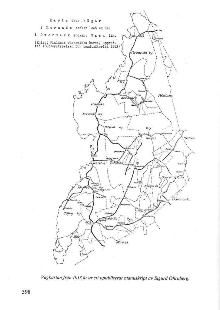
Man’s – https://www.brage.fi/sve/draktbyra/draktbyran/folkdrakter/view-163648-75 - Korsnäs Kommun, Kornas Historia, Näarpes Tryckeri Ab, 1981, page 598
- Korsnäs Museum, http://www.korsnas.hembygd.fi/in_english/the_museum/
- Korsnäs Parish Map 1913, http://urn.fi/URN:NBN:fi-fd2015-00007808/