By June Pelo.
Along the King’s Road there exists an uncounted number of old buildings and sights. The important road has turned to an interesting series of sights as well as entertainment. Follow the steps of kings, step into mighty mansions and churches, visit redecorated old villages and idyllic cost towns, wander in castles and enjoy the beautiful nature in archipelago.
Overview
The King’s Road has been one of the most important routes and it is presently one of the top travel routes in Scandinavia. In the past centuries the road went from Åbo, the previous capital of Finland, to St Petersburg via Paimio (Pemar), Perniö (Bjärnå), Pohja (Pojo), Siuntio (Sjundeå), Espoo (Esbo), Porvoo (Borgå), Pernaja (Pernå) and Virolahti. Outside Finland the road goes through Sweden to Norway. The King’s Road can also be considered as Emperor’s road since its other ending point is St Petersburg. In the Middle Ages the King’s Road was the most important road in a strategic and administrative manner. However, it wasn’t used until 1293 when West Karelia was attached to the Kingdom of Sweden.
The oldest road in Finland is the Bull Road of Häme (“Hämeen härkätie”) which goes from Åbo to Hämeenlinna. The Great Savo Road from Hämeenlinna to Savonlinna was also one of the major roads. Åbo Castle, the castle of Häme and Viborg Castle were all built in the 13th century and Olavinlinna Castle was built in the 15th century. In the 16th century the castles were connected by these well known roads.
In Finland the name King’s Road was used rarely. The only difference to other roads was that it was maintained by the crown. In many urban districts between Åbo and Viborg there were similar but smaller roads and paths that have been included in the so-called Coast Road. From time to time the road has been changed. There was one road in the summer and the other one in the winter.
The King’s Road region covers all these roads. The King’s Road has had many names. It is called the Common Road from Viborg to Åbo via Uudenmaa (Nyland), the Coast Road, the Southern Coast Road, the Great Military Road, Old Russia Road, the Post Road from Åbo to Viborg (after the post office was founded in 1638), the Common Road and the Lower Viborg Road. Actually there was also the Upper Viborg road which could have been used since the beginning of 15th century to travel to Åbo using a longer route through Hämeenlinna.
In the Middle Ages travelers made their way on foot or rode a horse along the King’s Road. Carts were rare at the beginning of the 18th century and the first carts were owned by foreign aristocrats. Roads were so narrow that when two carts met the other cart had to give way.
After St. Petersburg was founded, the Coast Road grew and it became an important route in Europe. At the end of the period of Swedish ascendancy it was improved all the way to the Ahvenkoski which had become a frontier in the peace of Åbo in 1734. In the 19th century gentle folk and merchants started to use four-wheeled-carts while peasants used two-wheeled-carts without any springs. Young Russian grand dukes found this piquant. Afterwards a more convenient cart, turkulaiskarry, was in fashion.
To travel from Åbo to Helsinki it took three days and from Helsinki to Viborg it took 2 days more. The first stop from Åbo to Helsinki was usually in Perniö (Bjärnå) or in Tenhola (Tenala), the next stop was in Fagervik or in one of the inns in Kirkkonummi (Kyrkslätt) or Espoo (Esbo). Russians conquered Finland in 1808 and emperor Alexander the First managed to travel by sledge from Åbo to Helsinki with only one night’s sleep.
From Helsinki it was possible to ride to Viborg in 20 hours and the journey to St Petersburg took only another 8 hours. The average speed was 13.5 km/h if the horses were changed. The post was still slow after 1640. In the end of the century it easily took a week to send mail from Åbo to Viborg. The amount of time decreased greatly as inns started to take care of mail.
The first inns were founded along the road already in the 14th century. In the beginning they were maintained by the church, afterwards they were owned by the crown or private people. Private people had more taverns than the crown. Jacob Teitt, the scribe of Gustav Vasa, names about twenty royal demesnes or parsonages which worked as stopping places.
The inn system became official in 1649. The noblemen got pub freedom in 1689 which allowed them to found new pubs as the traffic became more lively. The pub and inn law which was made in 1649 upheld to the 19th century. In the time of autonomy and independence the number of inns decreased and traffic development began to have more influence on the location of inns.
The importance of Åbo in the Grand Duchy of Finland decreased when Helsinki became the new capital. Inns had located from ten to twenty kilometers from each other. Automobiles and railways change the role of the inns. Soon the inns were more like hostelries. The last of them was closed early in the 20th century.
The Great Coast Road which could be used to travel to Novgorod in the Middle Ages had flourished under the period of Swedish ascendancy in 18th century. It was used by diplomats, soldiers and foreign travelers to travel to St Petersburg, the new capital of Russia.
Presently the King’s Road which connected western and eastern parts of the super power of Sweden is one of the most important tourist routes in the north. It runs to Viborg and St Petersburg via Norway, Sweden, the Åland Islands and southern part of Finland. The King’s Road is full of interesting and original sights thanks to its rich history. It’s not only the history that makes the King’s Road so interesting. The meeting of the east and the west is visible also in everyday life: in people, behavior, language, speech, attitude and environment. The King’s Road is alive. It offers science, art, technology, international culture events, city life, walkways, shops, cafes, real country life, tastes, adventures in the nature and lots of more.
Finland’s share of the King’s Road
Åbo-Viborg main road from the Middle Ages, now known as the King’s Road, is one of the oldest roads in Finland. It was used by kings, their couriers, other officers and soldiers. The road and its surroundings have changed but still travelers can contact with the past. The route is still the same and the countryside on the road is old. It is often been wished to develop the road more attractive to tourists and to mark the route with signs, rocks and plants. It is also suggested that the road should be protected by law. Sometimes there arises a question whether a name of the place on the historic road is dignified enough. That clearly shows how interesting and important the King’s Road is.
Presently the King’s Road is no longer unbroken. New big highways, driving bans, light traffic routes, etc. have changed the road. In Espoo the King’s Road divides in 25 smaller roads. It’s not possible to create one continuous road anymore.
History
The King’s Road, known as the Great Coast Road, runs from Åbo to Viborg via Paimio (Pemar), Perniö (Bjärnå), Pohja (Pojo), Siuntio (Sjundeå), Espoo (Esbo), Porvoo (Borgå), Pernaja (Pernå) and Virolahti. Juhani Viertola writes in “Suomen teiden historia” that the road was the most important road in strategic and administrative manner in the Middle Ages. However, it’s not the oldest road in Finland because Uudenmaa (Nyland) was populated so lately. It cannot have been in use before the year 1230 because that was the time West Karelia was attached to Sweden. There are some notes about the King’s Road from the end of 14th century and the more frequent notes from the 15th century shows that there was a lot of traffic already by that time. Eventually at the end of 14th century and in the beginning of the 15th century it became as important route as the water route on the coast of Uudenmaa. For a long time it was easier to travel on sea than by road. We would hardly call those roads. In our eyes they would look like narrow paths.
In the Middle Ages it was possible to travel on foot or riding a horse; to travel by vehicle became possible much later. In the winter it was easier to travel when the snow made the road flat. It was also more convenient to travel by sledge than riding a horse.
In the land laws of Maunu Eerikinpoika (Magnus Erikssons landslag) at the end of the 14th century the width of the road was set to 10 ells (one ell equals 59 centimeters). However, only a few of the roads were that wide. Until the 16th century the roads were riding paths and goods were transferred by a pack horse or using two poles and a cloth.
Gustav Vasa ordered the roads repaired in the 1540’s and in the next century the kings of Sweden-Finland continued to improve roads. By the end of the 17th century almost all the roads in southern part of Finland were good enough to travel by wheels. The distance pillars were also helpful when traveling on the road. Order of the road width of 10 ells was reformed in 1734 but still in the middle of the century the King’s Road wasn’t that wide everywhere and when two vehicles met the other one had to give way. There have been inns on the road since the 14th century. Finally they were owned by private people.
The Postal system was set up in 1638 -1643 and by the end of the century post was transported regularly. In the beginning the post was carried on foot but as early as 1640’s horses were being used. By the schedule the mail sent from Åbo on Sunday was in Viborg in Wednesday evening. It took often a week, however.
During the autonomy roads were improved and in the 1820’s the roads in southern part of Finland were in a very good condition. The length of the roads were measured in versts instead of ten kilometers. By the year 1833 there were verststones along to road (one verst = 1059 meters).
Peasants who owned the land were responsible for upholding the roads. The King’s Road was a public road and all peasants took part in the repairing, working by the day. The smaller roads were in the area of responsibility of local peasants. Rural police chiefs made sure that the work was done and summoned a person who neglected his/her duty before the district court. Until 16th century the burden wasn’t too hard and only a few peasants were given a fine.
The peasants also had to offer accommodation to soldiers who used the King’s Road and they had to help in transportation. The burden was reduced a lot as royal demesne was found in 1556 since it took care of most of the obligations.
The route of the King’s Road is drawn exactly in the maps in the 18th century. Most likely the route was about the same before that. F.J. Fonseen, the surveyor, who made the first map of Espoo parish describes the King’s Road in these words:
“These roads are in the hilly country and edged with rock. They are in moderate condition, however. The roads are ditched both sides and filled with sand and gravel. The forest is cut down 10-12 ells away from the road so that wind and sun could dry it.”
Everyone wasn’t satisfied with the condition of the King’s Road. District governor Anders de Brucen (1723-1787) recommended travelers use the road that went via Hämeenlinna (Tavastehus).
In the 18th and 19th centuries peasants felt the maintenance of the road as a real burden. Most of the cases in district courts dealt with upkeeping of the roads and bridges. Landowners weren’t interested in making improvements and even smallest improvements took years of struggle. In the 18th century the maintenance of roads included transportation of gravel and ballast, ploughing and repairing of bridges.
Bridges and Inns
Up to the 19th century bridges were made of wood and they needed constant maintenance. Wooden bridges were ruined easily and became unsafe to use. In Espoo there is a stone bridge on the King’s Road that is one of the oldest bridges in Finland. It is mentioned in the district court in 1778 and the bridge was probably made a year before that.
The inn network in Finland is from the Middle Ages
The basic idea was to offer services to travelers. In the beginning the services included food and lodging for the night, later also transportation. Gustav Vasa decided that there had to be one inn in every county. The inn keeper was chosen in the district court and he/she was expected to provide a lot. In the inn there had to be different rooms for noble and common people, good sheets, proper cooking equipment, large enough stable, enough horses, saddles, carts, as well as hay, straw and corn for those who used their own horses. Inn transportation was mainly used by ranked people as well as priests, officers and surveyors. However, they usually didn’t use the services because they weren’t satisfied with the quality of the inns. Most of the common people couldn’t even afford the transportation since ten miles transportation cost one day’s work.
In the 18th century the inn transportation system was changed to so-called hotel transportation system; each inn had to have certain number of horses with driver no matter how many travelers there were. The burden was shared by the land owner. One shift lasted two or three days. It wasn’t easy to split the burden evenly among the peasants. They were unwilling to do their share and often disagreements were solved in the district court.
The construction of the railroad in the beginning of the 20th century had an impact on roads usage as well as inns. The roads in the southern part of the Finland became local transportation routes and longer trips were more convenient to make by train. The inn transportation was needed only on roads that weren’t near the railroad. The inns also had to be placed near railroad stations so that different transportation systems gave support to each other. Eventually time passed by the inn system and the horses had to give way to cars. In the 1920’s a bus transportation was established in Espoo.
Names of the King’s Road
The King’s Road has many names; it is impossible to say how old they are. People have had local names for some parts of the road which described the location or route of the road.
In 1974 new names were added and those were printed on the map in 1975. New names included roads such as Mankintie, Finnsinmäki and Finnsintie. Kuninkaankartanontie was followed by the Road of Erik Basse, Hansatie and the Big High Road. The last one continued to the Muurala Road without any disconnections. Next to Keha III was, and still is, the Huhtaniitty Road and the King’s Road. The new roads, the Kolkekannas Road, the Pitkäjärvi Road, Pitkäjärvenranta and the Jupperi Road, were marked north and northeast of the park of Träskända mansion. After 1974 the names haven’t changed much: most of the names have been proposed and accepted to be used in local plans. The committees who are responsible for the names have made only little modifications because of local plans or different road dispositions.
The name King’s Road comes from the same common word. In Nordic countries the maintenance of the roads has been the government’s responsibility for a long time. The old custom was that the biggest roads were the King’s responsibility and that is the meaning of the name King’s Road. Other meaningful names are main road, district court road, church road and mill road. The names also indicated who was responsible of the maintenance of the road.
In royal decision in 8th January, 1735 it was ordered that a road is considered as the King’s Road or common main road if it goes from one staple town or highland town to another and there are inns along the road and the road is at least 10 ells wide. Rural District Court could also promote a new main road if necessary.
Sights on the King’s Road
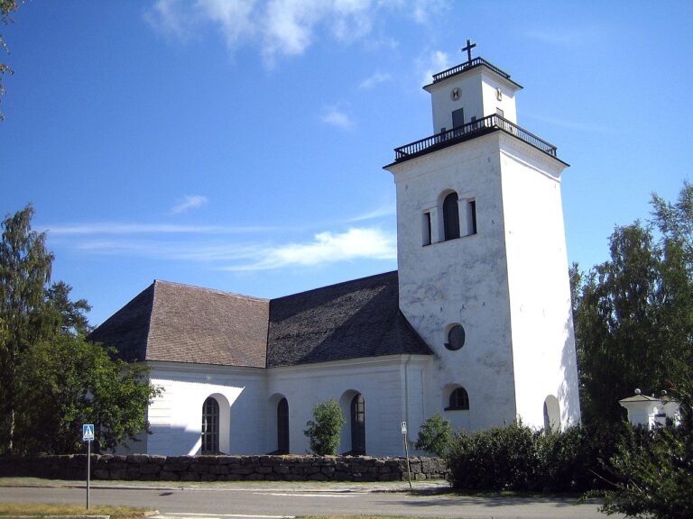
- Church of Perniö: The main church of Perniö was built in the Middle Ages for Saint Lauri. The construction was finished in 1480. It is one of the grey churches in south-east Finland that were built as Christianity became stronger.
- Fiskars Ironworks: For almost 350 years iron and copper have been refined in Fiskars Ironworks. The ironworks dates back to 1649, when it was owned by Peter Thorwörstin, a merchant from Turku.
- Åbo Castle: The history of the castle begins from the 1280’s. The summer camp of Swedish king’s viceregents and soldiers has grown into a huge grey castle.
- Suomenlinna sea fortress (Sveaborg): This valuable fortress is admitted to the List of World Heritage Sites of the United Nations.
- Langinkoski Imperial Fishing-lodge: Fishing-lodge made of timber by Russian emperor Alexander the Third in 1889.
References:
- The city planning office of Espoo
- Kuninkaantaantie
- Kungsvägen
- The Internet
- Ulla Rautanen
- Mikä on historiallinen Kuninkaantie
- Väinö Wallin
- Suomen maantiet Ruotsin vallan aikana, p. 3-4
- Kuopio 1893
- http://www.ruthvilmi.net/hut/King/kings_road2.html